Estimated Depth to Bedrock in the State of Wisconsin
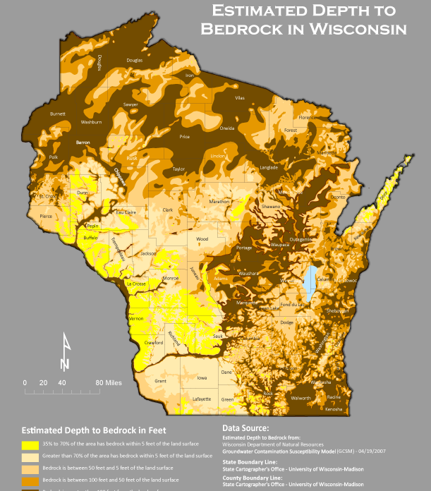
This map shows the estimated depth-to-bedrock in the state of Wisconsin.
Knowing depth to bedrock is crucial for activities like permitting, utility installation,
bridge construction, road construction, and the land application of waste materials in some sensitive areas.
These activities require an understanding of the underlying geology, groundwater flow, and land use.
According to an early map created by Trotta and Cotter (1973), the thickness of these unconsolidated materials in Wisconsin
varies from 0 feet in locations of exposed bedrock to over 500 feet in other portions of the state.
The data layer for this map was obtained from the Wisconsin DNR Open Data Portal.
