Traffic Fatalities in Wisconsin by County - 2016
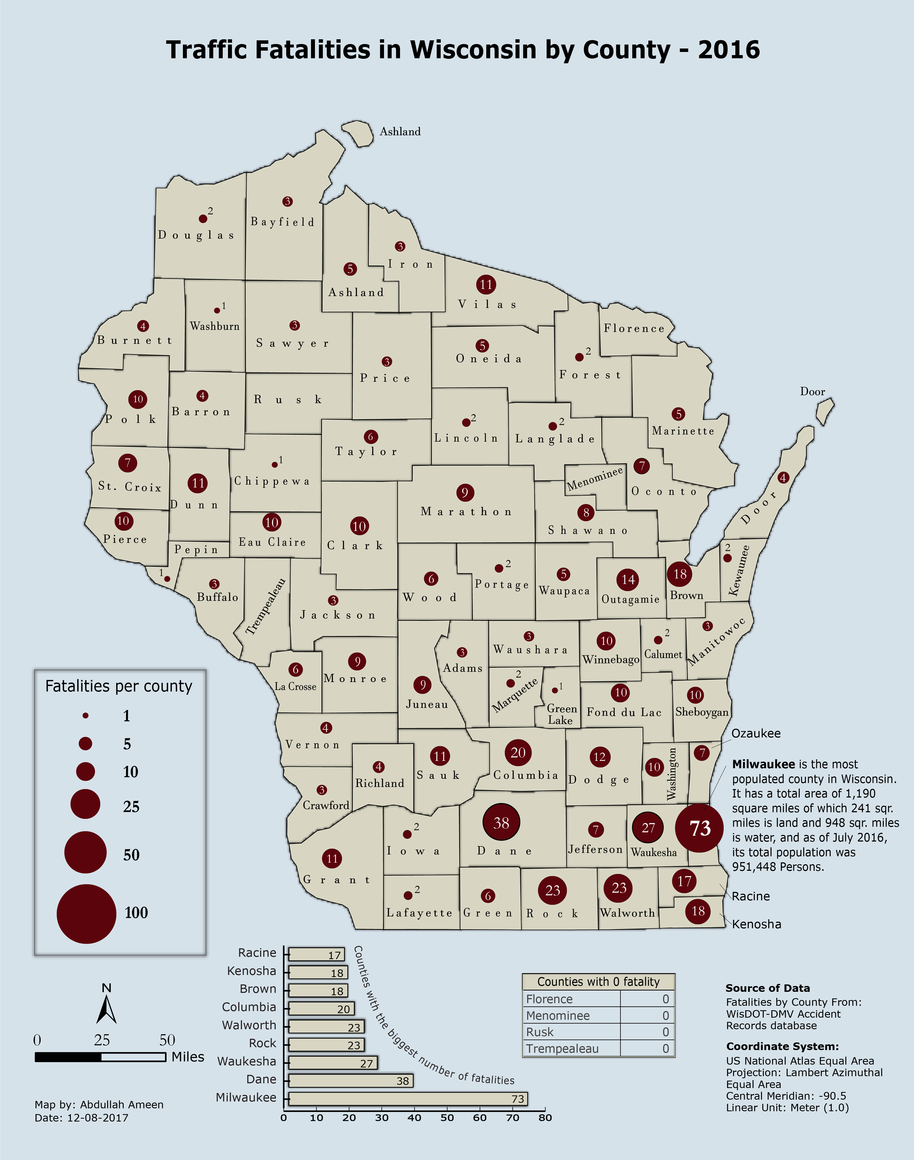
Below proportional symbol map represents the traffic fatalities in Wisconsin by county in 2016.
Proportional symbol maps are used to show relative differences in quantities among the features or an attribute field of a special dataset.
For more detail on proportional symbol map, please click here.
Data source: WisDOT Crash Records database
Copyright © Abdullah Ameen
